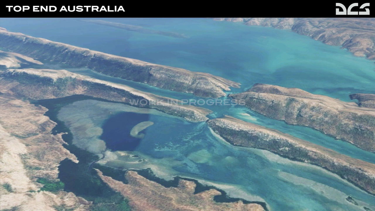
Eagle Dynamics has announced DCS: Top End Australia map by third-party developer Check Six Simulations is now in development.

The Top End Australia map covers 1,400 × 800km of Australia's mainland, including the Western and the Northern Territories. With a mixture of civilian and military airfields, the map features a rich red outback landscape complemented by lakes and rivers, floodplains, coastlines and Darwin city centre.

Major landmarks have been detailed, such as Mindil Beach, Darwin, Broome, Tindal, Curtin, and the Delamere Weapons Range. Stay tuned for future news as Eagle Dynamics look towards a report on their progress soon.

Read more about Newark’s Canberra is facing the axe RAF Tornado retirement
This is a premium article and requires an active Key.Aero subscription to view.
I’m an existing member, sign me in!Premium Key Aero subscribers get access to read all our magazines online as soon as they leave the editor’s desk.


 Sign In