Hi all
it seems that better weather is underway and that means that we can start planning new trips. One thing I always use to plan a trip to an airfield is my TomTom Sat-Nav system. To put the right photo spots in my Tom Tom, I use Google Earth. Google Earth has proved itself very useful to search for the best spots around airfields and with the output of this program you can then fill your sat-nav system again.
I have gathered a reasonable amount of photo spots in google earth/tom tom but I could use some help. Does anyone of want to share their spots so I can compile a large database and make it available online so we can all benefit ?
You can download my Google Earth file here and load it in Google Earth. Using http://www.poieditor.com/ you can then convert this file to your TomTo, Garmin, Navman or many more systems
Download: http://franknoort.nl/airfields-europe.kml.zip
please send your updates to [email]frank@franknoort.nl[/email]
Here is how it looks like
http://maps.google.com/maps?q=http://franknoort.nl/airfields-europe.kml
Some previews:
Online (see also http://maps.google.com/maps?q=http://franknoort.nl/airfields-europe.kml)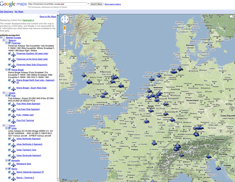
In Google Earth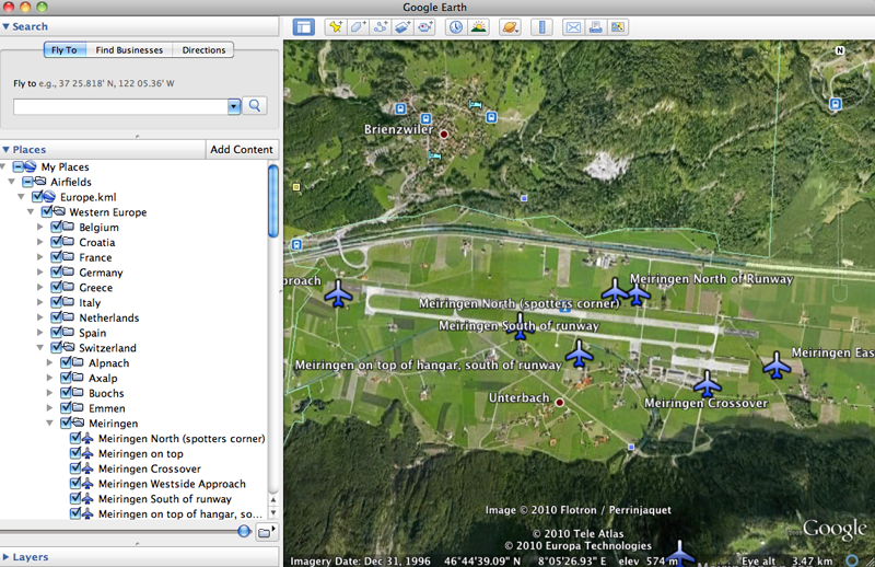

By: Bograt - 6th April 2010 at 15:15
That’s one cool idea Frank; a suggestion – how about also adding Wrecks and Relics around the airfields? For instance, the Mirages at Creil which are on the far side of the airfield and you really have to know the route to find them.
Happy hunting!
Grtz
Bograt


 Sign In
 April 5, 2010 at 2:19 am