Early in July I will be visiting Vanuatu (used to be the New Hebrides).
As part of that trip I will be traveling from Port Vila to Espiritu Santo, spending time in each.
Of interest to me is the WW2 seaplane base at Segond Channel, where as well as the US Navy squadrons, the RNZAF did base Catalinas.
I have accessed the ‘Pacific Aircraft wrecks’ website, but would be interested in finding out any other info that may be available on Catalina operations in this area and what if any remnants are still available to view.
Any other aviation artifacts still viewable on these two islands?
(I am aware of the ‘Million Dollar Point’ area, but prefer to keep up in the air rather than down under water. In short, I do not dive).

By: flyernzl - 18th March 2015 at 07:13
I am saddened by the reports coming in of the devastation caused to Vanuatu by tropical cyclone Pam just a few days ago.
It would seem that Efate has been very badly damaged, but I think Bauer field is still operational.
The southern island of Tanna has been comprehensivly flattened. Estimates of 70 to 80% of the buildings there being destroyed.
I have not seen any reports of damage to Santo. Being quite a bit further north it may have escaped the worst.
I would assume that any aircraft that failed to escape would have been destroyed, as hangerage in Efate is extremely limited, and non-existant elsewhere.
My thoughts go out to the people there.
By: Mo Botwood - 6th August 2011 at 10:24
Thanks for the trip down memory lane. We spent two years in Vila when the Brits employed me as an Air Traffic Controller at Bauerfield.
I spent many days travelling to the North of the Island, particularly stopping off at the old Officers Mess at Havannah harbour, which sits at the end of the old Fighter strip. James Michener was an officer in the Navy and most of his stories were written in that concrete structure.
The history that I was fed re Quoin Hill, was that the CBs tried out their tests on its construction. The final layer was live coral, which they kept alive by sacrificing tankers in supplying sea water to the runway for two weeks before leaving it to die. By that time the live coral had grown into the main levels and in dying, cemented them together. You cannot press the proverbial car key into it. Only half of the Quoin Hill strip is out of the scrub and it is considered capable of handling the heaviest of aircraft. C130s of the RNZAF and RAAF would spend the odd hour or two doing circuits over there, including full stops.
Many items of warfare are advanced as winners of particular campaigns, but in the South Pacific – the Bulldozer was supreme. Americans established airfields in a quarter of the time taken by the Japanese.
Flyernzl, memsahib deserves as many shoes you can find for her!!
Mo
By: flyernzl - 6th August 2011 at 07:08
Thanks for the appreciation guys.
It’s been a hell of a lot of work, but interesting nevertheless.
Any plans to visit anywhere else in the Pacific for similar purposes?
Simon
Over the years I have been to Norfolk Island, Fiji, Tonga, Independent (Western) Samoa, Tonga, Cook Islands, New Caledonia and Tahiti/French Polynesia.
I have, to the best of my ability at the time, tracked down and visited ‘places of aviation interest’ at each of them and photographed what I found at the time.
There are still a few more to cover – Lord Howe Island being one, but that had little of aviation interest apart from the flying boat service.
If anyone has a particular desire to find out details of any of the above locations, ask and I’ll see what I have stored away.
In the meantime, looking at the matrimonial brownie points scorecard, I feel that the next couple of overseas trips will be entirely devoted to shopping for shoes!
By: Discendo Duces - 5th August 2011 at 21:31
Peter
Thank you so much for such a detailed and fascinating set of posts.
Great photos of the locations as they are today, with excellent background information to put it all into context.
DD:)
By: snowen250 - 4th August 2011 at 15:32
A stunning thread thanks so much for posting it, i’ve enjoyed reading it very much! Any plans to visit anywhere else in the Pacific for similar purposes?
Simon
By: ozjag - 3rd August 2011 at 12:16
As I said previously I have really enjoyed your adventure, thanks for sharing it with us. A lot of people have viewed this thread so take that as a huge compliment.
Paul
By: flyernzl - 3rd August 2011 at 09:23
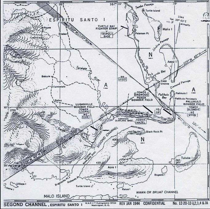
A second seaplane base, Sarakata, seems to have been established near what is now the town centre judging by this January 1944 chart. Presumably it was only used by smaller seaplanes than the PBY base at Belchif. The area would now be part of the modern harbour installations. The callsigns of the various airfield control towers are interesting.
That, folks, is about all that I got.
Had a good poke around some modern lighty stuff at Bauer, there appears to be no GA activity anywhere else in the country.
If you do get the chance for a Vanuatu trip, grab it. There are a lot of good things about the place and they have an interesting history.
Also there is obviously scope for a lot more in-depth research on the WW2 aviation scene than I have been able to cover here.
Many thanks to Shorty, Ozjag and Seaplane Paul for their invaluable gen plus those locals who helped.
In the meantime I’m off to the nearest dead airfield (as my wife calls them) to hitch a lift home
By: flyernzl - 2nd August 2011 at 09:00
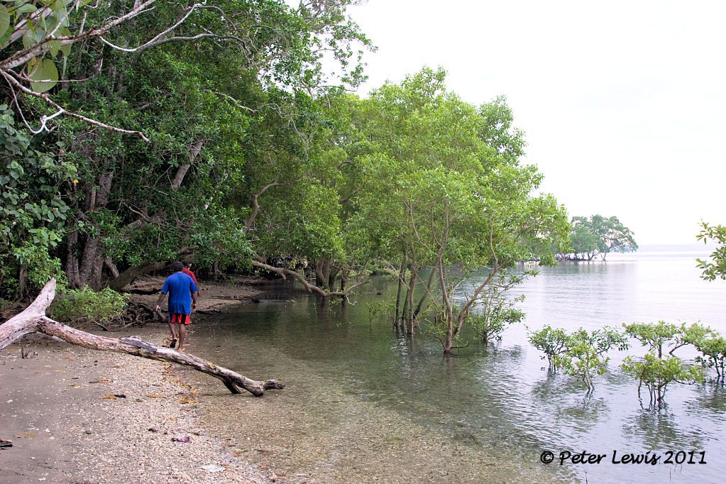
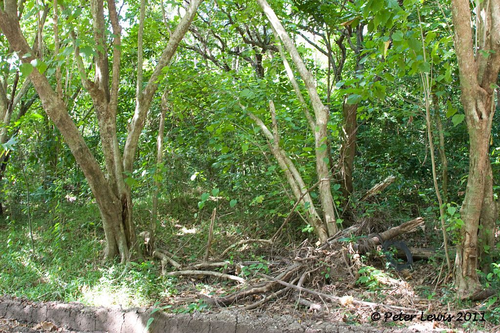
First light the following morning we sneak along the coast road, pausing only to admire the sunrise over Belchif Point. The beach just to the right of the point is our intended destinantion
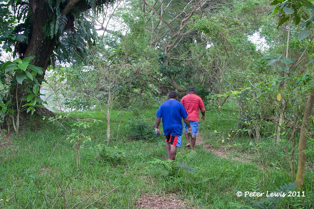
At the river, we abandon the car and take to foot power. The site is well overgrown, and some of the plants are a bit dangerous. The broad leaf ones are Dendrocnide spp, known locally as Nangalat or nettle tree. This is a variety of stinging plant that thrives in Vanuatu. If you brush against the leaves it will give you a painful rash that lasts about a fortnight. Avoid.
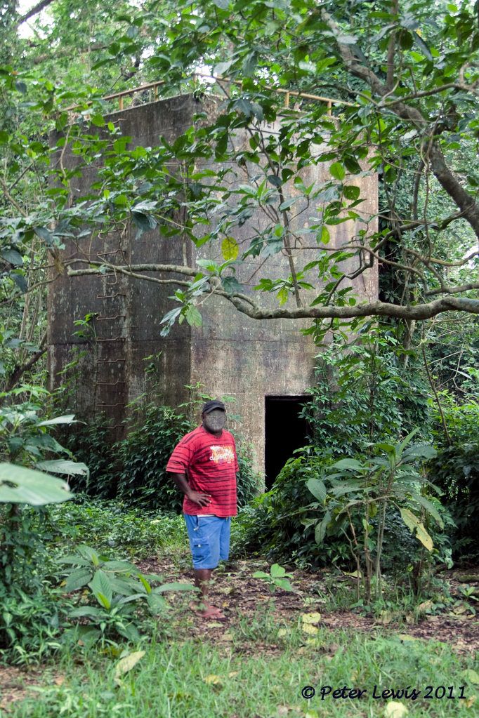
The first artifact we come to is the control tower, being concrete it is about the only structure on the site that has survived.
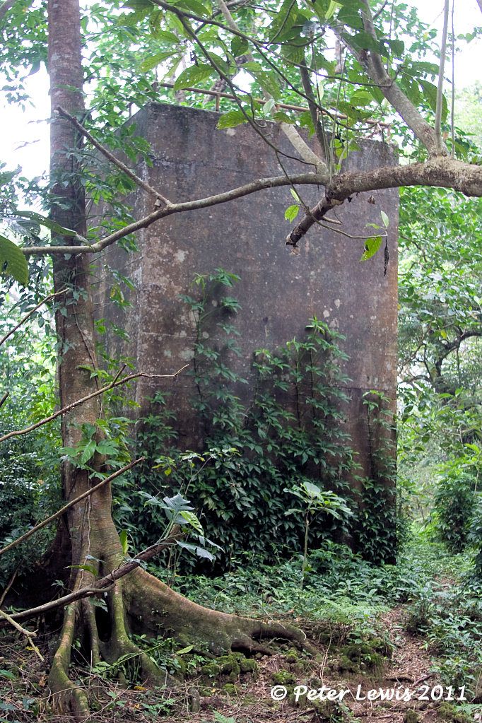
Feeling a bit like a participant in Raiders of the Lost Ark, I investigate further. The steel ladder rungs have rusted to the point where they would be unsafe to climb
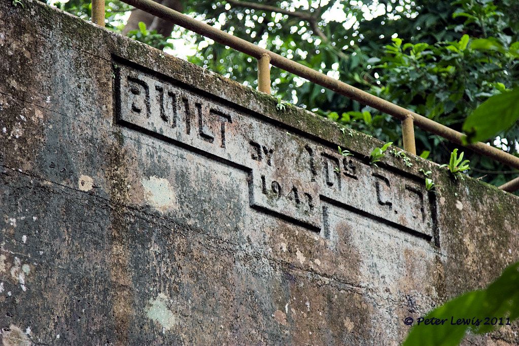
The makers have left their mark – 40th Construction Battalion 1943
Working our way down to the waterfront entails paddling through a swampy area
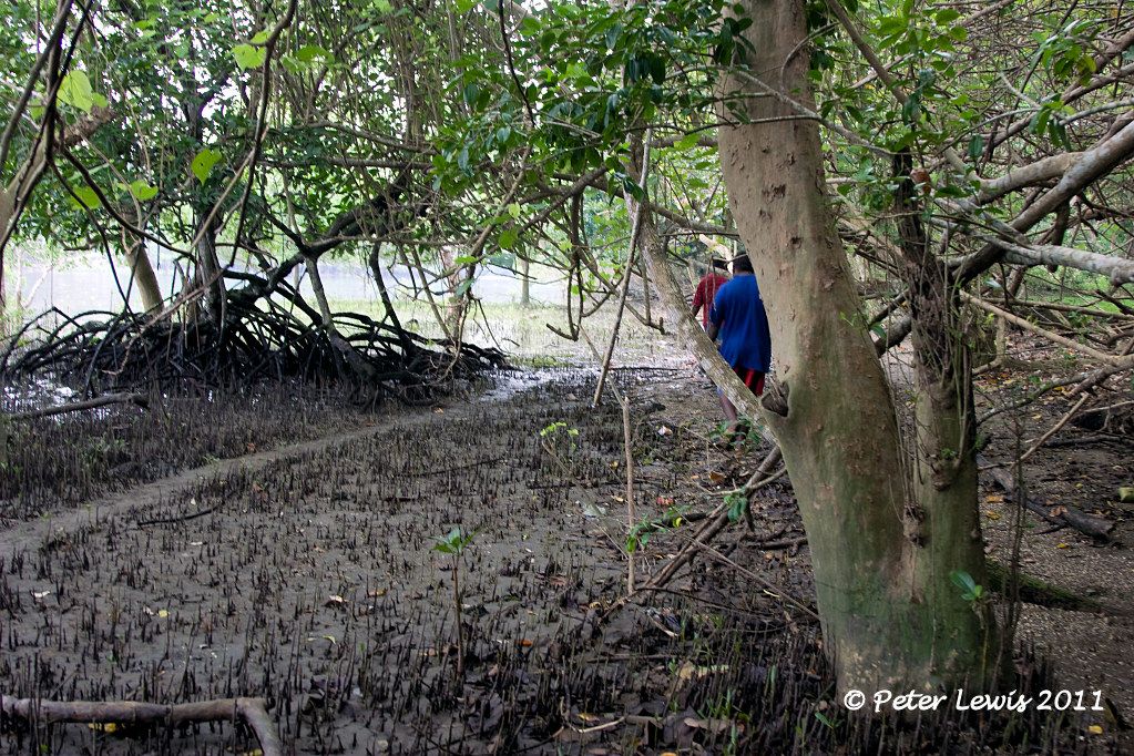
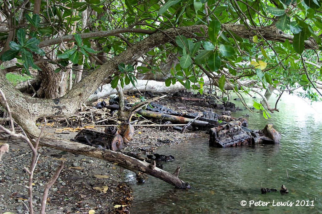
and we eventually arrive at the beach
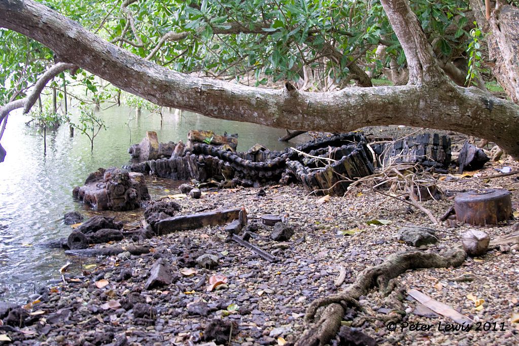
First stop there is at the remains of the wartime wharf
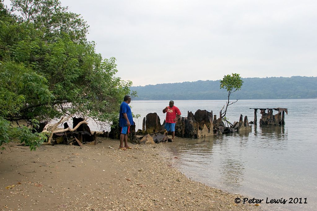
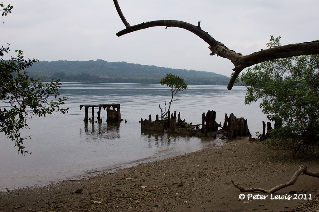
Alongside this structure is one of the two seaplane launching areas, with the marston matting still visible in places. Seems to be a Catalina strut in there as well.
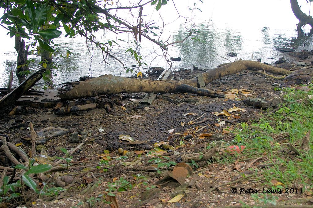
Back behind us, the area where the seaplane station was active is now heavily overgrown. However, some of the concrete tie-down are still visible
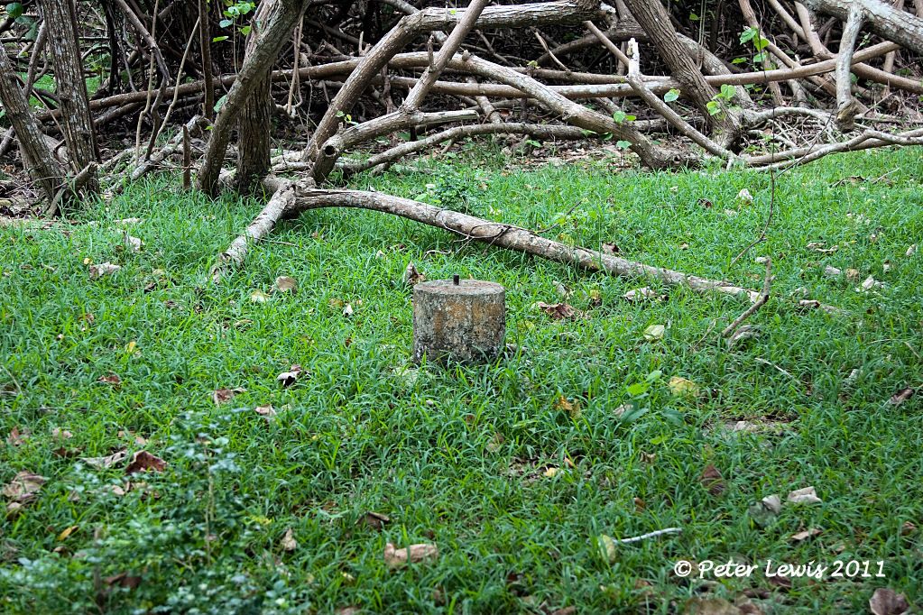
Some debris, mostly related to ground handling equipment, lies scattered among the trees
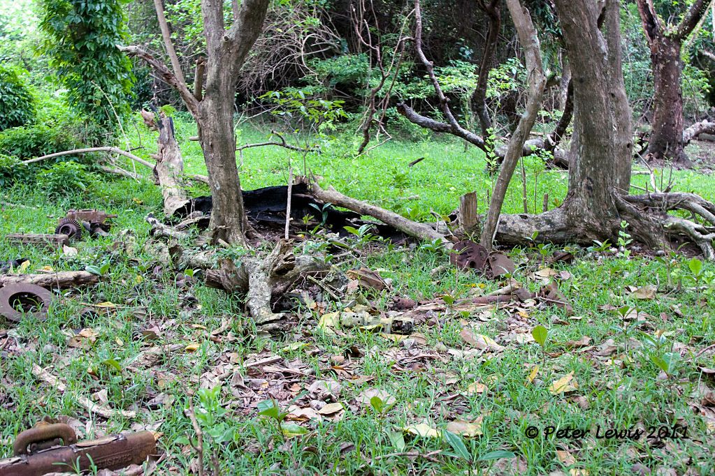
The beach is also littered with rusty artifacts
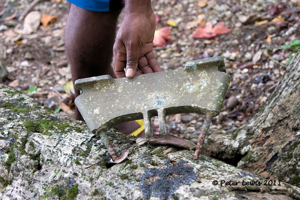
Seems to be a wheel off Catalina beaching gear
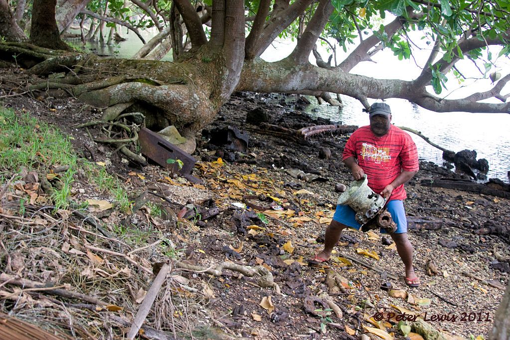
Resisting the urging of my guides to ‘grab a souvenir’, we return to the public road as silently and as quickly as possible.
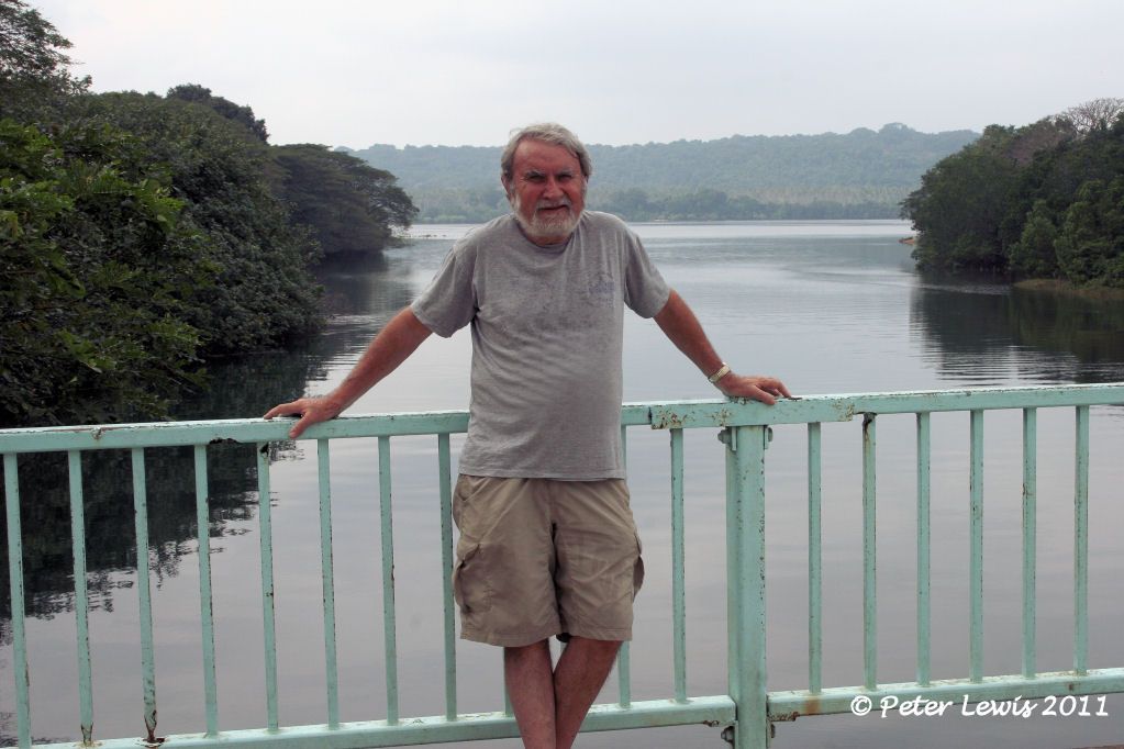
Operation Stealth is over. We stop for a breather on the Wamba River bridge. I think I am the wrong shape to be Doctor Jones, I’ll leave that to Harrison Ford.
By: flyernzl - 1st August 2011 at 10:45
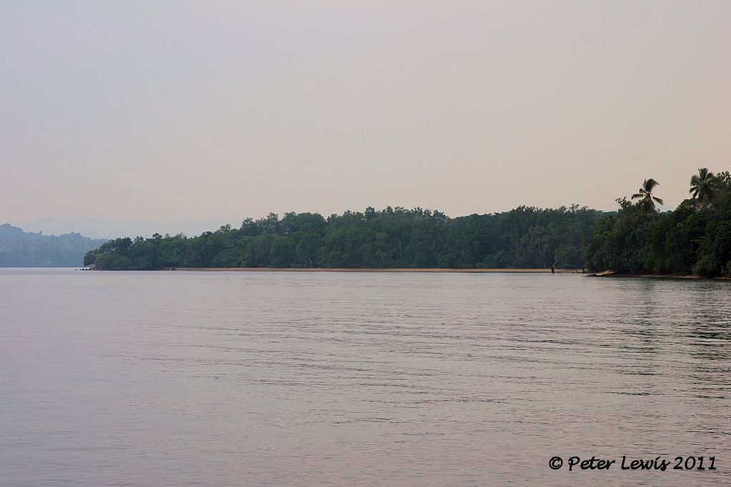
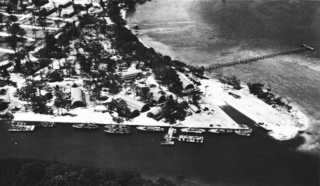
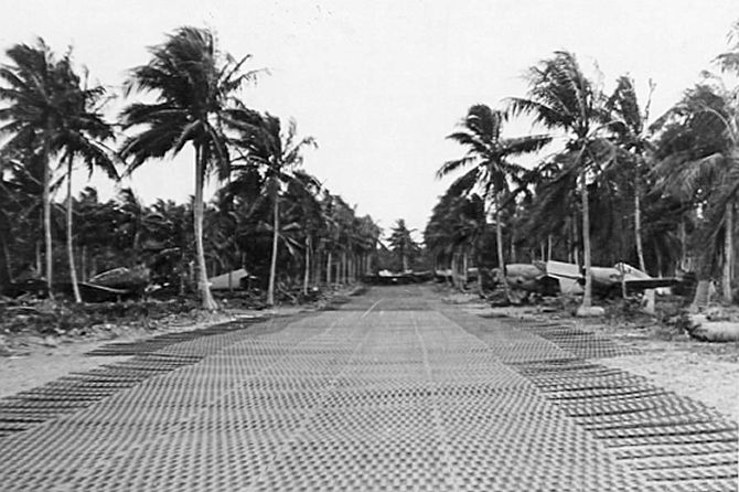
A seaplane base was established in 1943 on the shores of the Segond Channel, south of the Luganville township at Belchif Point alongside the estuary of the Wambu River.
“For a seaplane base, the 7th Battalion constructed a parking area, two pre-fabricated 85-by-100-foot nose hangars, warehouses, quonset huts, and two seaplane ramps in Segond Channel.”
Seaplanes were an essential feature of the war in the Pacific. Apart from their ability to patrol vast areas of ocean, they were vital for rescue work. At this time, in an area larger than continental Europe, there were around 15 ‘friendly’ airfields available to Allied aircraft. Consequentially standard practice for any allied aircraft in trouble was to head out to sea, radio position details, and ditch. The nearest Catalina base would then hopefully dispatch an aircraft to effect a rescue.
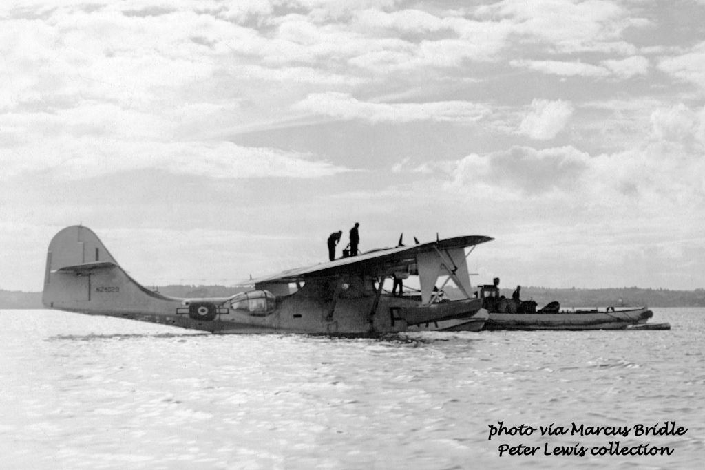
The RNZAF had acquired 56 PBY-5 and PB2B-1 Catalinas under lend-lease from mid-1943. They were all Seacats – pure flying boats not amphibians.
6 Squadron was declared operational with Catalinas at Fiji in August 1943 and moved to Santo the following October. They then moved on to Halavo Bay in the Solomon Islands in December 1943.
5 Squadron acquired their Catalinas in Fiji July 1944 and moved to Santo in October. Moving back to Lauthala Bay, Fiji, in November 1945 they retained a detachment at Santo until the following year.
RNZAF Catalinas at the Segond Channel Base during this time
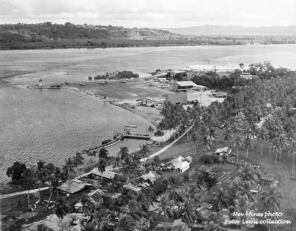
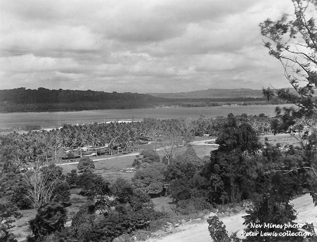
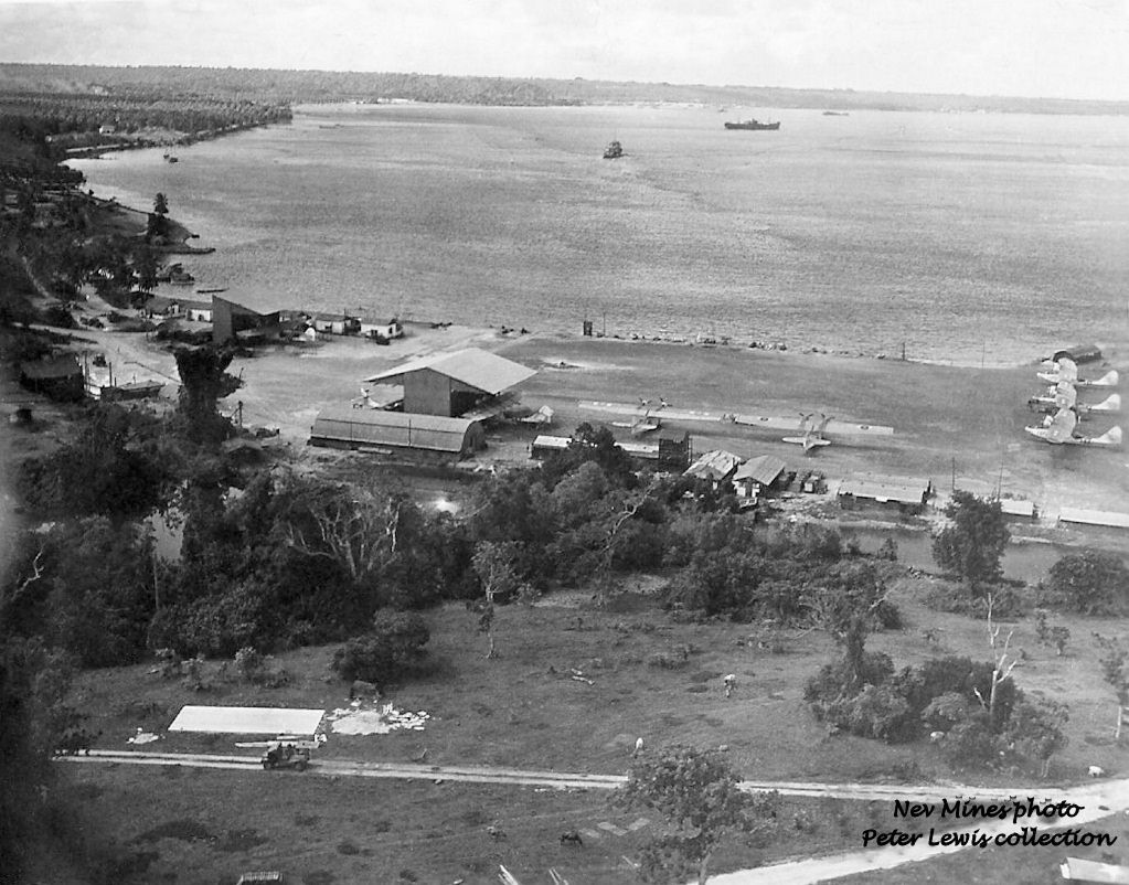
Above photos via Nev Mines
NZ4029 Espirito Santo 30Sep1945
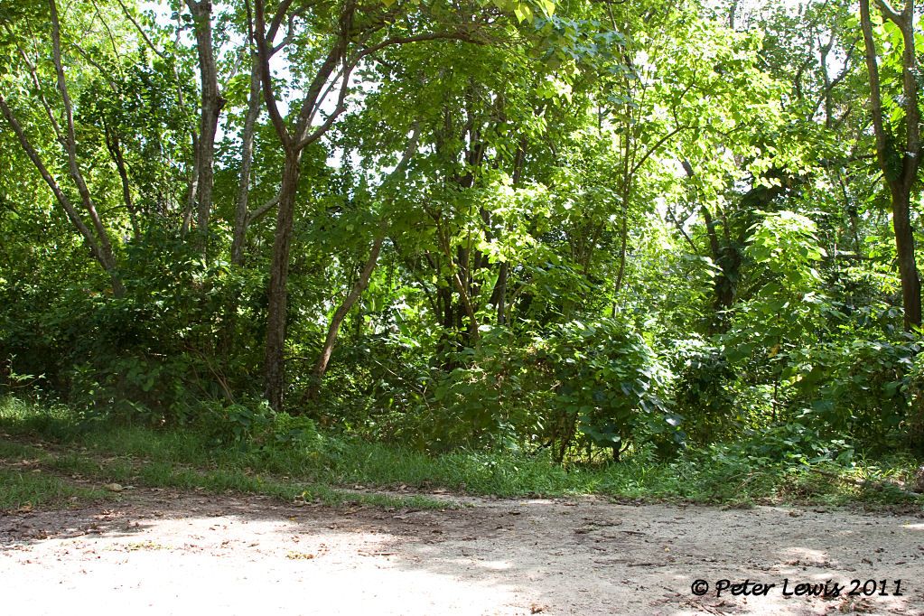
Naturally, I was keen to visit this area and investigate what remained on the site after all this time.
However, all land in Vanuatu belongs to someone, even the waterfront. No ‘Queens chain’ of public property here. I was firmly told that access to this area was not available. You can drive along the public road and cross the Wambu River bridge, but that’s as close as you can get. The owners are not willing to allow any visitors
As usual, I wailed and bemoaned my fate. Here I was, so close and yet so far. I had come 1500 miles and could go no further.
My wife, who is well used to my moods, took a more practical approach. She spoke to a waiter. The waiter had a second cousin who just might have a friend of a friend who could possibly arrange something.
So there was a clandestine meeting in a back alley by the light of the moon. Promises were made, gold and virgins changed hands. (OK, I’m exaggerating a bit here, but you get the drift). A covert early morning operation was arranged, a quick silent stealthy in-and-out promised.
Stand by for the next gripping update.
By: flyernzl - 31st July 2011 at 09:23
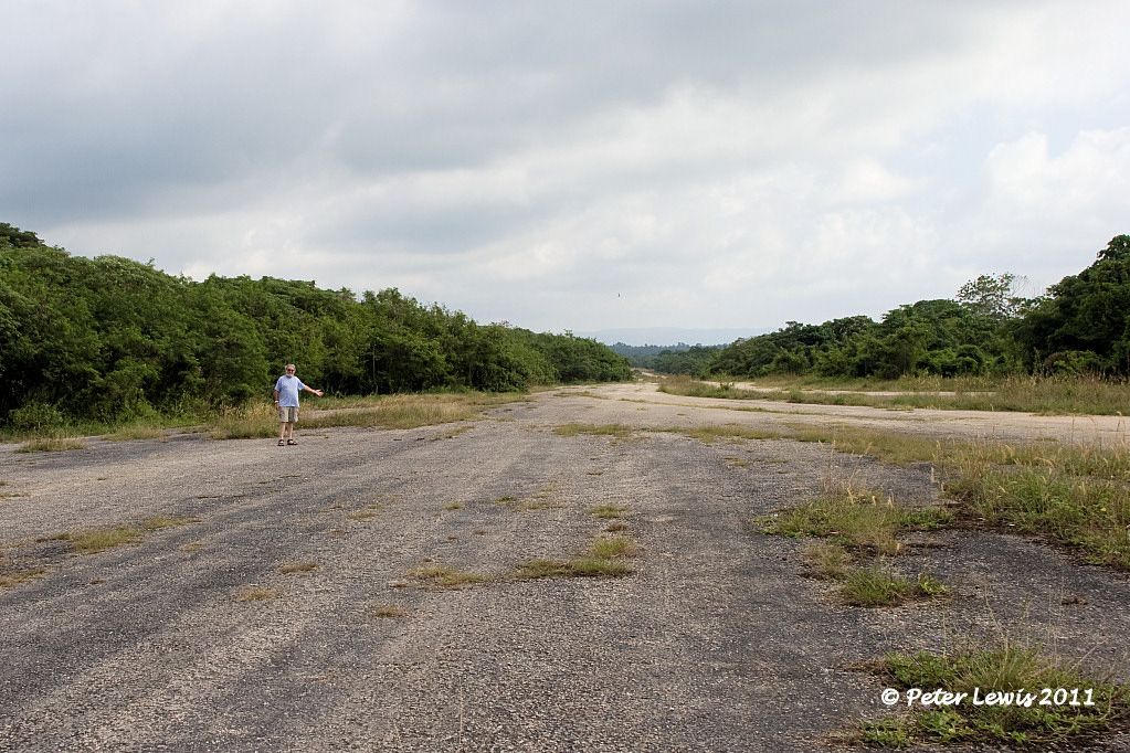
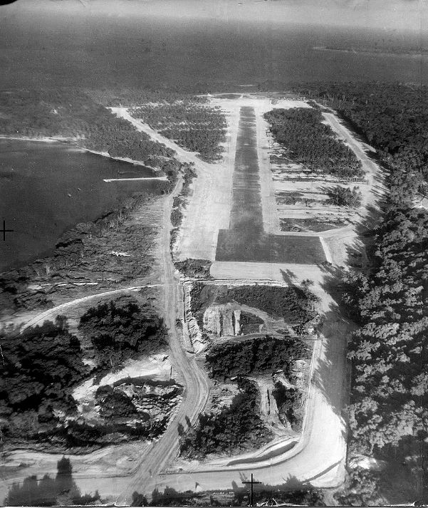
The third and final airstrip to be built in the Luganville area was Bomber 3.
This field is located on a ridge in the hills to the northwest of the town.
“The 40th Battalion reached Santo on February 3, 1943. The principal project of this battalion was the construction of a third bomber field at Luganville. A runway, 6,800 feet by 300 feet, with 27,000 feet of taxiway and 75 hardstands, cut out of dense jungle, was completed in 120 days. Nearly a fourth of the runway was in solid-coral cut ranging from a few feet to 35 feet in depth; 3,000 feet of taxiway and six hardstands were also in solid coral cuts averaging 10 feet. Coral for surfacing and necessary fill was obtained from the cuts and from borrow pits. Because of the heavy rainfall in the area, the surface of the coral was treated with an emulsified asphalt binder.
“Additional facilities constructed for the operation of the airfield included a tank farm of six 1,000-barrel steel tanks, two truck-loading stations, two repair areas, fifteen 40-by-10-foot arch-rib warehouses, one 100-by-90-foot hangar, eighteen 20-by-48-foot quonset huts for living quarters, six mess halls, and all necessary utilities. Fifteen miles of two-lane road, for access to and operation of the airfield, were cut through dense jungle.”
Bomber 3 runway on completion, 1943
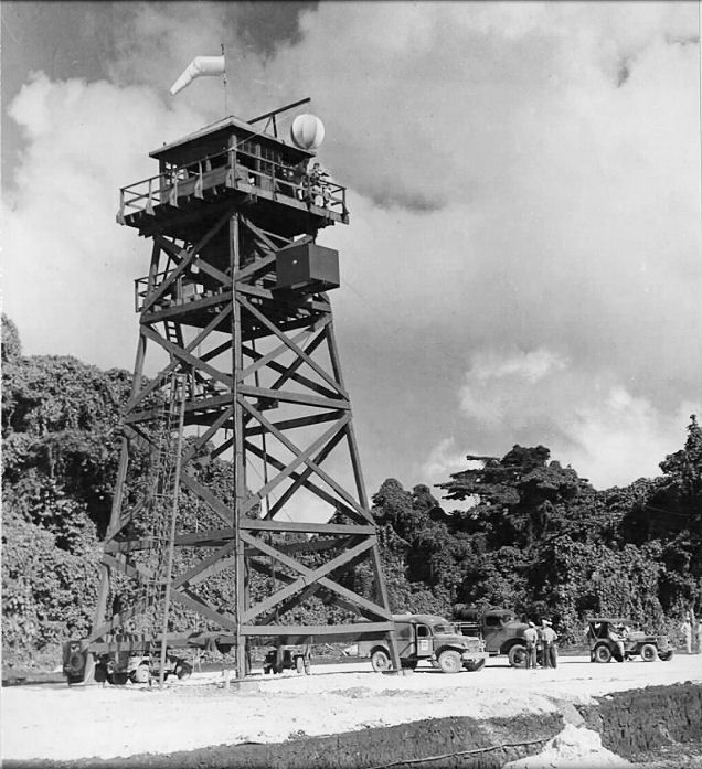
Control tower facilities at Bomber 3
As this field was asphalt coated, rather than utilizing marston matting, it remained in service during the 1950s and 1960s as the civil airport and became Luganville Airport. One local I spoke to remembers cycling out to the field to watch the arrival of Queen Elizabeth II for a royal visit to the territory in the early 1960s.
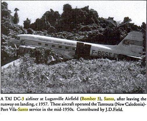
Of course, there were incidents at the airfield during these times
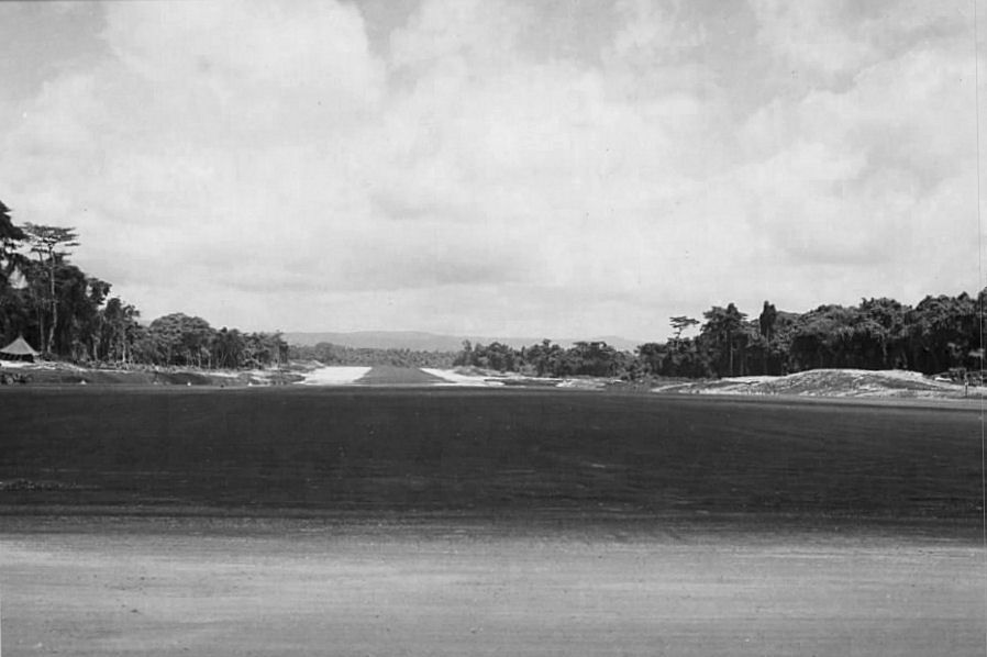
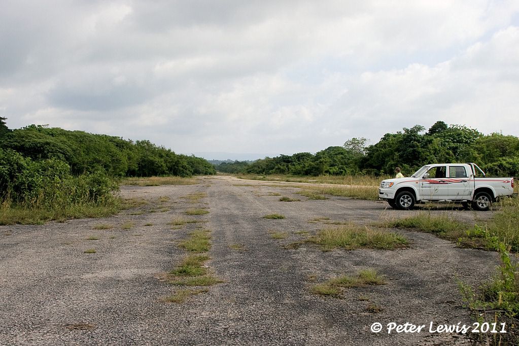
When upgrades to the facilities became essential, the decision was made to renovate Pekola and close the Bomber 3 strip. The airfield is still very accessible, as the road to the Millenium Caves, a popular tourist experience, passes right through the site.
You could certainly land your Cessna single on the strip
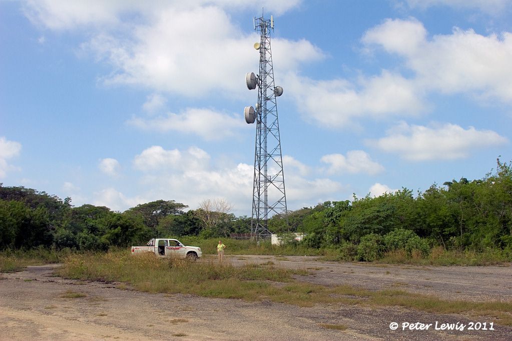
Looking North down Bomber 3
Turning around, looking South. The radio towers are in current use.
By: flyernzl - 30th July 2011 at 05:45
As the build-up of Allied forces on Santo continued, it became obvious that more airfields would be required to handle the planned offensive operations of the Guadalcanal campaign.
“Working in cooperation with a company of the 810th Army Engineers (from August 1942), the 7th Battalion also cleared, graded, and surfaced with coral a runway of the same dimensions (as Bomber 1) at Pekoa (Bomber Field No. 2).
“The work at Bomber Field No. 2, which had been begun by the 7th Battalion, was also taken over by the 15th. They completed the construction of a 7,000-foot-runway, having a steel-mat surface on coral, and built taxiways, revetments, and miscellaneous structures.
“The 36th Battalion also built an aviation supply annex of twenty arch-rib buildings, and six 1,000-barrel gasoline storage tanks at Bomber Field No. 2, with a connecting pipe line to a tank farm at Bomber Field No.1”
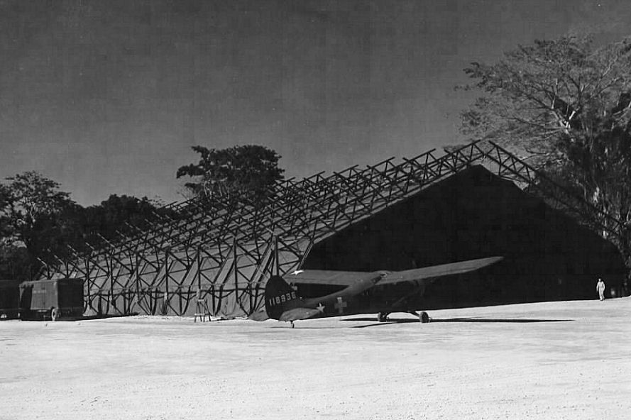
Some workshop hangars were erected at Pekoa. These were of prefabricated steel frames and canvas covers. One could be erected in four to five days. They were big enough to house a B-24
Bomber 2/Pekoa consisted of a single runway 6,400′ x 150′ with taxiways and revetments off both sides of the strip. Even so, there were the inevitable accidents.
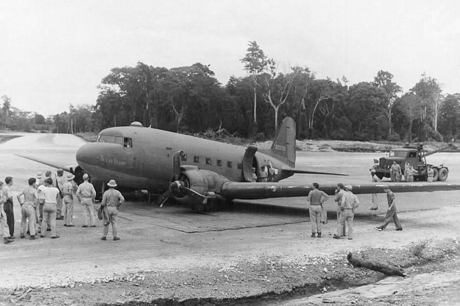
USAAF C-47 at Pekoa after the undercarriage retracted on take-off 12 January 1944
I find that many of the wartime photos said to be of Bomber 2 are actually, on close inspection, found to be photos of Bomber 1.
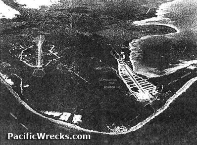
Bomber 2 in 1943 on the left in this photo – Bomber 1 on the right, from pacificwrecks.com
This field was closed upon the US withdrawal from the area in 1945.
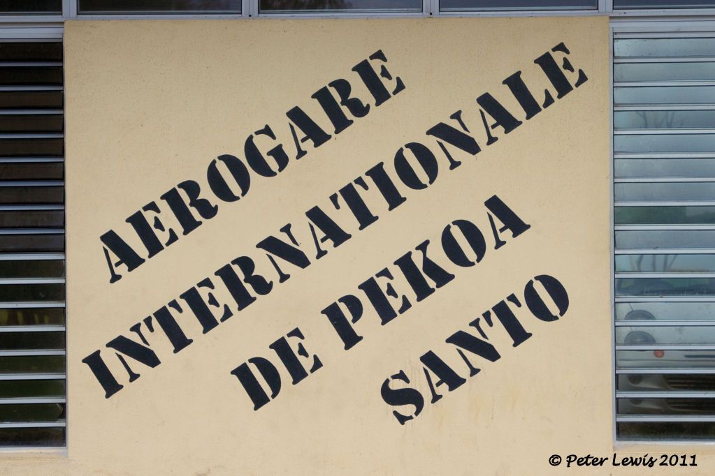
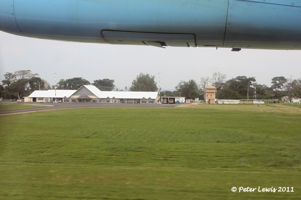
However, in the early 1970s it was reopened and refurbished to become the main civil airport on Espiritu Santo, with several flights each day between Pekoa and Vila.
In recent years the airport has been upgraded to ‘International’ status, hosting direct flights by Pacific Blue to and from Australia by B737.
You can’t miss the name, these days
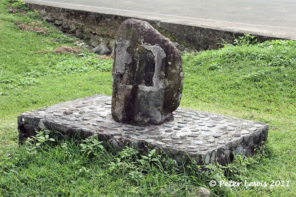
This stone plinth is outside the terminal, presumably a memorial plaque was attached at some stage but has now been removed
There appears to be no GA activity
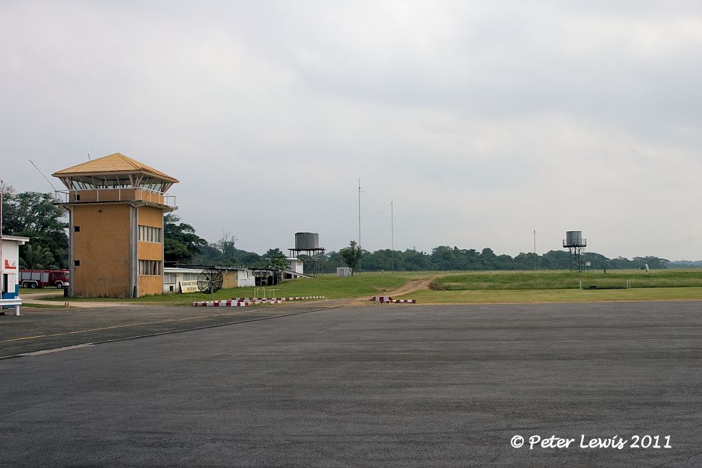
The runway was sealed in 2005
The modest set of terminal buildings
By: JDK - 28th July 2011 at 10:44
Thank you for the very detailed and informative posts, I have greatly enjoyed reading about your adventure.
Seconded! You’ve obviously done your homework, too.
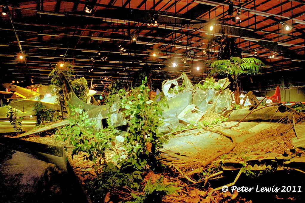
…frankly I couldn’t tell what it is although looking at my photo there is a turret ring so was most likely an Avenger.
Having another look, definitely a Grumman Avenger – see the cutaway here which matches lots of the details and angle.
Cheers,
By: flyernzl - 28th July 2011 at 10:30
Once the Turtle Bay airfield was operational, it was obviously essential to develop more air bases for the intensive war operations that were envisaged.
A site adjacent to the Palikulo Peninsular was chosen for the development of a bomber airfield, this was closer to the supply facilities of the Segond Channel.
“On August 11, 1942, the 7th Battalion arrived and immediately began construction of more extensive air facilities to support the Guadalcanal campaign. They began work on two fields to support bomber operations.
A runway, 5000 feet by 150 feet, of steel mat on an 8-inch coral base, was constructed on the shores of Palikulo Bay (Bomber Field No. 1). Working in cooperation with a company of the 810th Army Engineers, the 7th Battalion also cleared, graded, and surfaced with coral a runway of the same dimensions at Pekoa (Bomber Field No. 2).”
When the 15th Battalion reached Espiritu Santo on October 13, 1942, they were assigned the complete overhaul of the grading and drainage of Bomber Field No. 1. They also added taxiways, revetments, and a 1,000-foot extension for air transport operation.”
This became the largest strip on the island, and was used by heavy bombers. By June 1, 1943 the runway was 6,200′ x 150′.
Bomber 1 (Palikulo Field), 1943. Segond Channel in the background, Palikulo lagoon on the left
Even at this size, the field still had problems:
“The landing in to Bomber 1 made me nervous, because the approach was designed to have the planes let down in a corridor that had been cut through tall rain forest trees, perhaps as much as half a mile from the end of the runway. The trees were trimmed so that those at the beginning of the approach were just topped, and as you neared the point of touch-down the trees were cut off at ground level. As the planes approached touch-down, well below the tops of the surrounding trees, I always hoped that there was plenty of wingtip clearance.”
Locals discuss the remnants of a crashed USAAF B-17 who’s remnants litter an area near this field. I am unable to positively identify the aircraft involved, the most likely seems to be a B-17 lost from an operation of 2Aug1943
“B-17E Flying Fortress, 41-2463, “Yankee Doodle”, of the 19th Bomb Group, then to 394th Bomb Squadron, 5th Bomb Group, crashes on takeoff due mechanical failure at Espiritu Santo, New Hebrides, Bombardier Sgt. John P. Kruger and navigator Lt. Talbert H. Woolam are killed. Pilot was Gene Roddenberry, future creator of Star Trek.The airframe was stricken on 13 August 1943.”
Also a casualty of Palikulo were RNZAF C-47 NZ3529 (when the aircraft swung off airstrip before becoming airborne on 06 July 1945) and SBD-4 Dauntless NZ5037 (lost 11 February 1944 after departing Bomber 1 for a radio familiarization flight, recovered and taken for display at the Wigram RNZAF museum 1998).
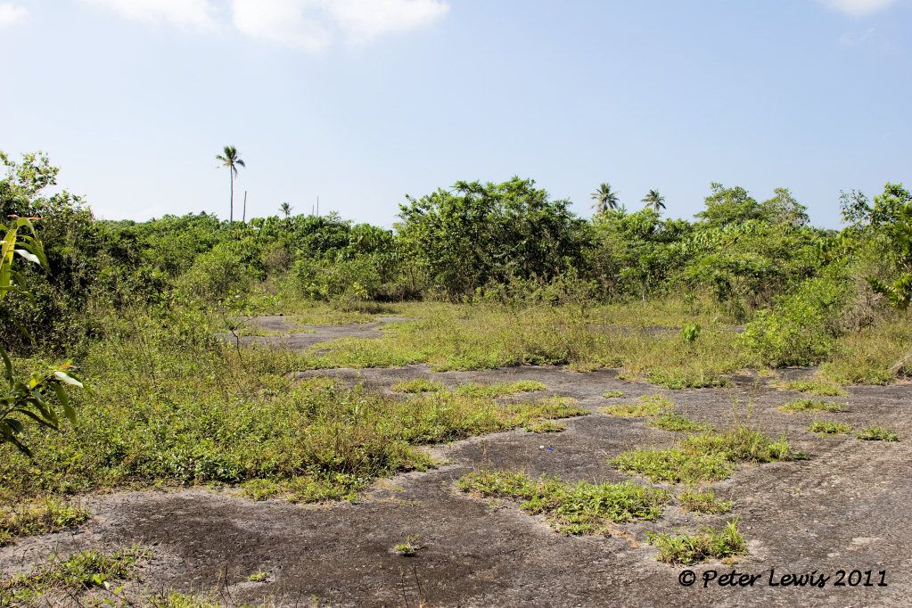
The airfield has been disused since the war, and (despite what pacificwrecks.com says) is now totally overgrown as the surface was merely coral, a good growing-ground for the tropical jungle.
The main road north from Luganville to Turtle Bay and Champagne Beach passes right across what was the main runway
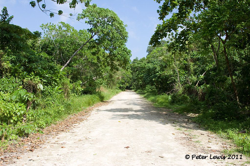
Looking left and right at the runway intersection, it is all now tiger country
(The recent photo of a clear runway said to be at Bomber 1 by pacificwrecks.com is actually a photo of Bomber 3).
One of the less desirable remnants from the US war effort in the Pacific is Persicaria perfoliata. This plant, known colloquially as mile-a-minute-weed was deliberately introduced into Vanuatu (as well as Fiji, Tonga and other Pacific Islands) as a fast-growing weed that would quickly grow over military installations and camouflage them. Unfortunately, when the war finished the plant remained, and today is a real problem is unattended areas. As you can see, anything could be hidden under its thick maze of barbed stems and triangular leaves. Sooner you than me to dig in there.
By: ozjag - 26th July 2011 at 16:36
Hello Peter
Thank you for the very detailed and informative posts, I have greatly enjoyed reading about your adventure.
As to the wrecked aircraft at Turtle Bay, I too had heard about it and in fact had a photo from a guide book (maybe Lonely Planet?) of it. I asked our guide if we could see it and he replied that the local chief had actually removed it from the airstrip to protect it a bit, the guide looked up the chief, asked if we could see it and then took us to the wreck you can see me standing on in post #8. It was in a lot worse condition than the photo in the guide book and frankly I couldn’t tell what it is although looking at my photo there is a turret ring so was most likely an Avenger.
Paul
By: flyernzl - 26th July 2011 at 10:51
Working from the top down on the above map, the first airfield constructed on Santo was at Turtle Bay. This field later became known as Fighter 1, and iss located near the coast on the eastern coast of the Espiritu Santo Island. Built in the middle of a coconut plantation, rows of palms were on each side of the runway.
Building the Navy’s Bases in World War II:
“A small reconnaissance party of three men left Efate on June 28, 1942, to find an airfield site closer than Efate to Henderson Field. Espiritu Santo was chosen, and on July 8, a small group of Seabees of the Efate detachment arrived at Santo with a Marine anti-aircraft battery and a company of colored infantrymen to begin work on Turtle Bay airfield.
The Santo pioneers were given twenty days in which to construct the field. They worked day and night, in the race against time. Equipment for heavy grading was not available and they had to make out with six tractors, two scrapers, one grease truck, one gas wagon, three weapon carriers, and one 50-kw generator. Assisting them were 295 infantrymen, 90 Marines, and 50 natives.
A 6000-foot runway was cleared and surfaced with coral in time to met the deadline. On July 28, the first fighter squadron came in and was followed the next day by a squadron of B-17’s. The planes were fueled from drums and gave the Japs in Guadalcanal their first big bombing on July 30.
Army Air Force and Marine personnel poured into the island shortly thereafter, and after the Marines landed on Guadalcanal on August 7, the new field at Santo gave vital support to that action.”
Although initially used by both US Marine fighter squadrons (Units VMF-214 and VF-33 operating Wildcats and Corsairs) and USAAF B-17s, the dangerously restricted surroundings saw bomber operations transferred to the Bomber 1 field at Pallikulo as soon as that became operational.
Fighter 1, surfaced with Marston matting and quite narrow for an operational field
VMF-214 on Turtle Bay fighter strip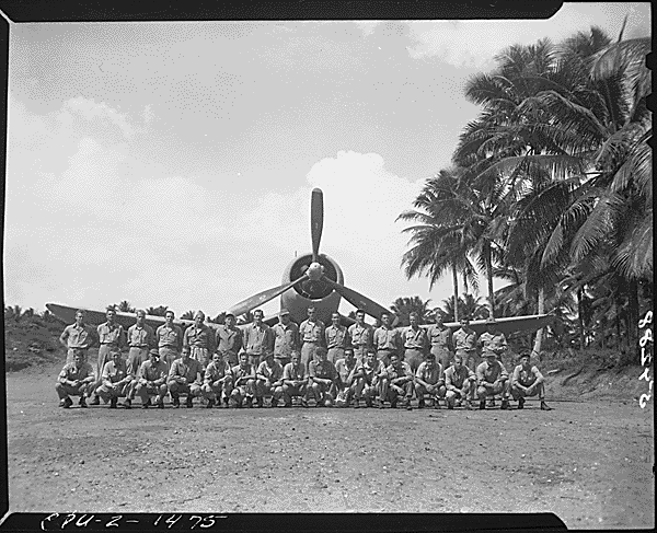
VMF-214 Black Sheep Squadron later moved base to Vella Lavella Island in the Solomon Islands.
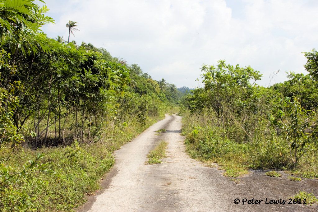
The strip has been disused since the war. However, the runways and roads are still quite evident, and can still be seen on Google earth
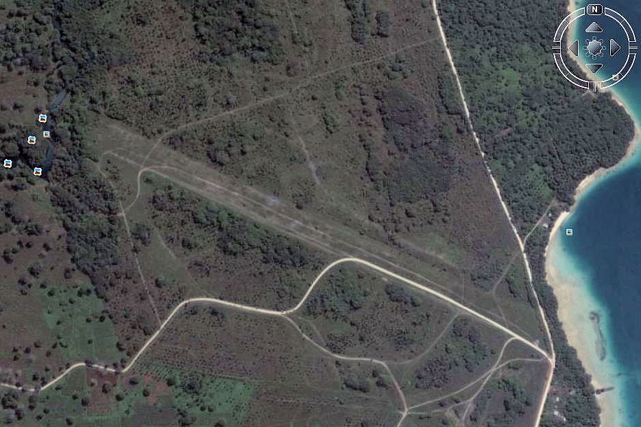
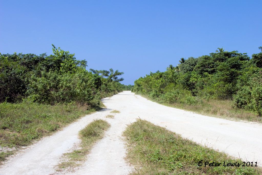
The main road north runs right past the entrance to the field, and as soon as you enter the gate you are right on the runway, looking west
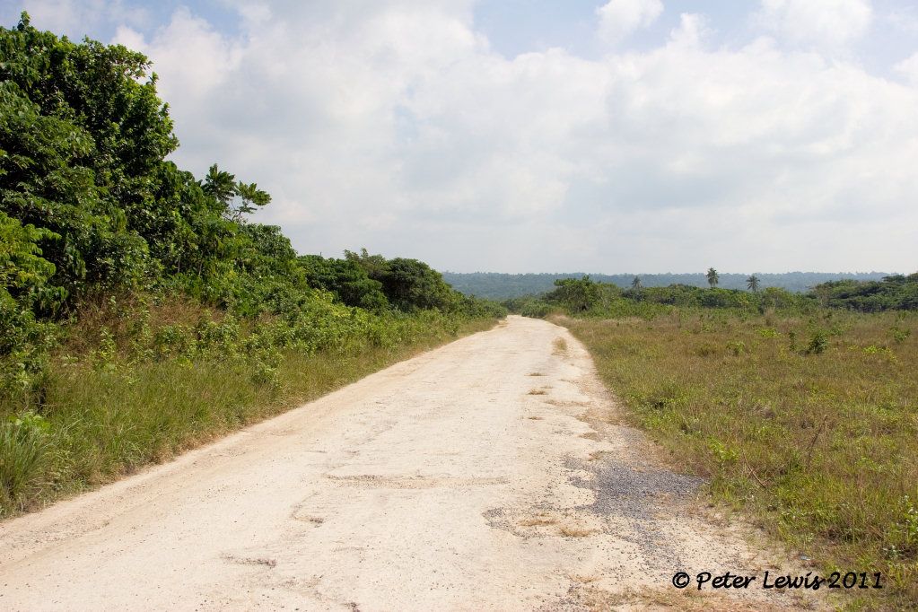
Drive down and looking back to the east
There are plenty of hard-stand areas, this looks like the compass swing station
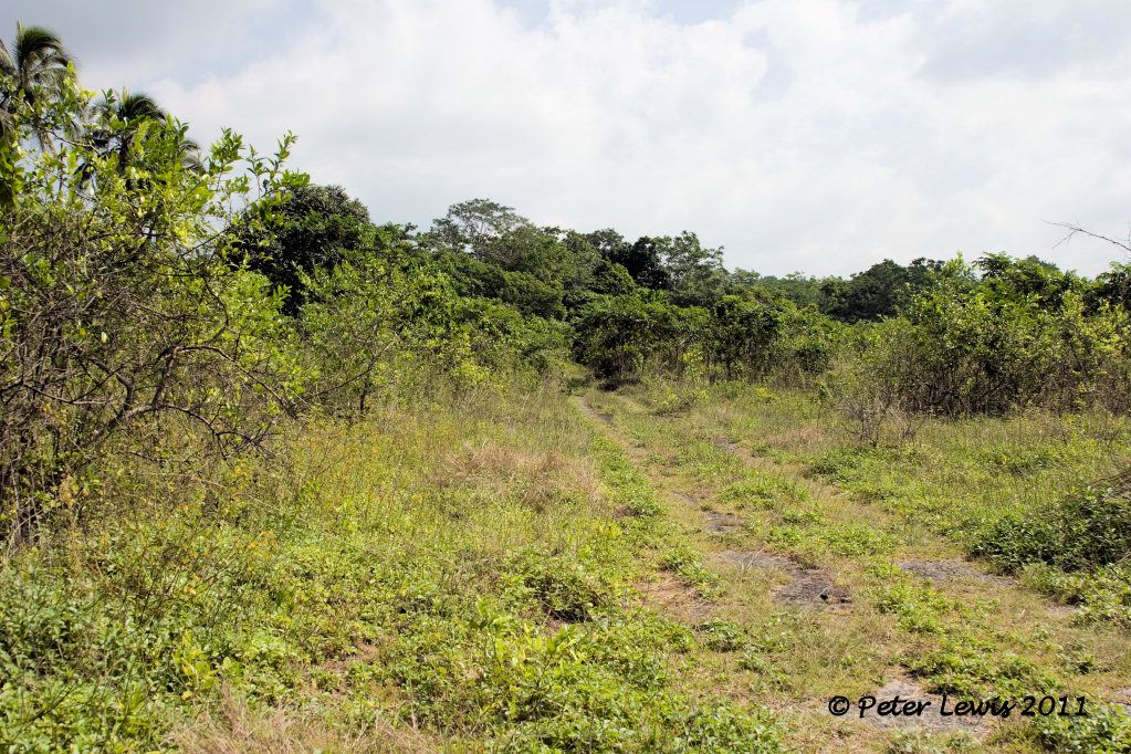
Tracks and trails head off into the undergrowth, but apart from the trails there is little remaining evidence that 4500 officers and men lived right here
One trail lead to the ‘Matevulu Blue Holes’ swimming area, still accessible if you are so inclined. There is an honesty box to pay a small fee for a swim, that is sometimes guarded by one of the locals.
One report mentions a wrecked American aircraft – possibly a Grumman Avenger – as being on site. I could not find any trace of this during my time there.
By: WV-903. - 20th July 2011 at 16:46
Great Post, thanks !!
Thank you for covering your Visit with great info and pics. They really bring it home on a not too well known subject over this side of pond.
Bill T.
By: scotavia - 20th July 2011 at 16:27
Thanks Peter great posts and images.
By: ozjag - 30th June 2011 at 12:35
G’day, I am no expert either! VMF 214 (first as the Swashbucklers and then as The Black Sheep) used a lot of different bases in WW2, they were based at Turtle Bay on Espiritu Santo during June/July 1943 before moving to Banika in the Russell Islands, they moved back to Turtle Bay in August 1943 for a while. All of this info from http://acepilots.com/usmc_vmf214.html and also the book ‘The Black Sheep’ by Bruce Gamble.
I have a photo of the wife and I standing in the middle of the airstrip at Turtle Bay.
Paul
By: J Boyle - 30th June 2011 at 10:41
Isn’t that on Vella Lavella Island in the Solomons?
Not Vanuatu/New Hebrides.
Ozjag said it was on Espiritu Santo. I’m taking him at his word…but I also recall they were at Vella Levella, so perhaps they were at both.
I’m not an expert on WWII USMC fighter bases in the remote South Pacific, I’m afraid.
By: flyernzl - 30th June 2011 at 10:33
Isn’t that on Vella Lavella Island in the Solomons?
Not Vanuatu/New Hebrides.


 Sign In
 June 16, 2011 at 1:54 am
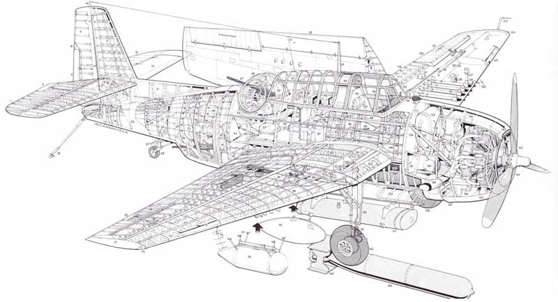