Hi all,
I was given this book by my Wife’s Grandad a few years ago. It belonged to his best friend who was a winch operator on target tugs at the end of the war. It seems to be almost a sort of tourist guide and is full of large pictures of landmarks and places of interest all around England. It was printed in 1941, although there doesn’t seem to be any reference to any armed service.
Anyway, here are some pics..
Any ideas what this book is and why it was printed? I know its not really related to historic aviation but I thought it may be of interest to some forum members here, given it’s wartime connections.
Thanks,
Tim

By: lankytim - 13th April 2012 at 14:06
Thanks for the info and opinions guys, very interesting! So it looks like a book of places to go and see after invading the U.K? I guess even invading soldiers have the odd day off!
The Rudolph Hess theory is interesting, infact the book had “This book belongs to R. Hess” on the inside cover. Of course, originality is important so I took the time to clean all the ink off. 😀
By: Arabella-Cox - 12th April 2012 at 16:48
My Gawd!!!…all that work and research by so many boffins…all a waste of time…it was all in the Hitler diaries, scoffed by so many to so many….Sealion in Northumberland. of course!!!!!
Well at least we can look forward to endless (mindless) hours of repetative theories and TV programmes from all the well known scourses…just like the horrendus accumalation of ‘sameness’ filling our screens at the moment called ‘Titanic’..
Why do you think Rudolf Hess made landfall near Bamburgh? He was on a secret mission to drop off a top-secret spy, disguised as a coal miner complete with whippet, packet of Woodbines and flat cap, who was to reconnoitre the Northumberland beaches. Hess selflessly sacrificed his freedom for the greater good (or greater evil, being politically incorrect and non-revisionist…).
(I think there’s some thread-creep going on here. I’ll get me coat…)
By: xtangomike - 12th April 2012 at 16:40
Usworth and Acklington were the RAF’s real front line – none of your Biggin Hill and Manston malarcky…they were just decoys! :p
My Gawd!!!…all that work and research by so many boffins…all a waste of time…it was all in the Hitler diaries, scoffed by so many to so many….Sealion in Northumberland. of course!!!!!
Well at least we can look forward to endless (mindless) hours of repetative theories and TV programmes from all the well known sourses…just like the horrendus accumalation of ‘sameness’ filling our screens at the moment called ‘Titanic’..
By: Arabella-Cox - 12th April 2012 at 15:02
The Northumberland coast? In a guide book for German troops pre Operation Sealion?
Gosh!
I see another element, now, to the previously untold story of 1940 that seems to have been missed in a certain recent book on the events of that period. Clearly, the invasion of Britain via the south and east coasts was all a huge bluff, anyway. The troops would have come ashore here, in Northumberland.
Only a few, and not many, know that! 😀
Usworth and Acklington were the RAF’s real front line – none of your Biggin Hill and Manston malarcky…they were just decoys! :p
By: Arabella-Cox - 12th April 2012 at 14:15
The Northumberland coast? In a guide book for German troops pre Operation Sealion?
Gosh!
I see another element, now, to the previously untold story of 1940 that seems to have been missed in a certain recent book on the events of that period. Clearly, the invasion of Britain via the south and east coasts was all a huge bluff, anyway. The troops would have come ashore here, in Northumberland.
Only a few, and not many, know that! 😀
By: Arabella-Cox - 12th April 2012 at 13:53
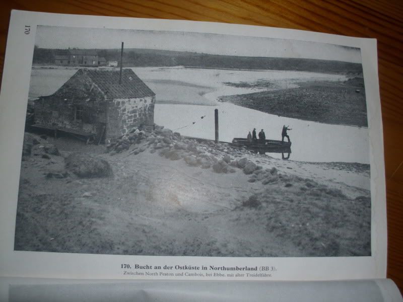
Cambois (pronounced ‘Cammus’) still looks a bit like that – the land that time forgot…:p
By: smirky - 12th April 2012 at 13:29
This may seem warlike as it is published by the General Staff of the Army but it is just Geography, we had (and almost certainly still have) a similar series of little books covering the whole World and published by a similar military department.
Has anyone got any? I’ve got one about Yugoslavia and it makes very dull reading. I also saw one once about the continental coast which was clearly for invasion planning – wish I’d bought it.
By: Bager1968 - 12th April 2012 at 07:02
Hi all,
It was printed in 1941, although there doesn’t seem to be any reference to any armed service.
Thanks,
Tim
Not to any specific military service, no… 😀
So just a collection of images and desciptions for the troops to let them know what to expect when invading England.
As well as to let fliers know what to expect when shot down… 😉
By: tenthije - 11th April 2012 at 22:24
To translate:
Page 1:
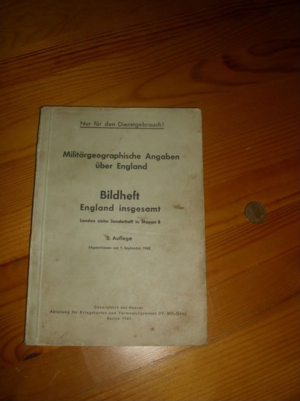
Just fur military services usage.Military geographical information about England
Picture book
All of England
For London, refer to folder B.3rd edition
Created september 1st, 1940
General staff for the army
Department of mapping and surveys
Berlin, 1941
Page 2:
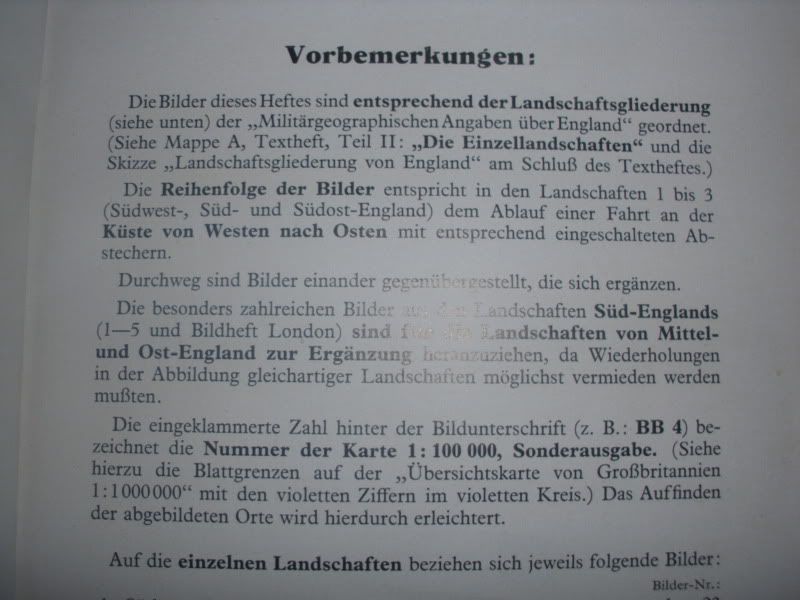
Introductory remarks
The images in this booklet are ordered by the typical landscape forms (see below) as sorted/displayed in the book “Military geographical information about England”. (See folder A, textbook, part II: “the individual land scapes” and [as displayed] in the sketch “English landscape layouts” at the end of the textbook.The order of the images relates to landscapes 1 to 3 (Southwest, South and Southeast of England) which you can find when travelling from the westcoast to the eastcoast.
So just a collection of images and desciptions for the troops to let them know what to expect when invading England.


 Sign In
 April 11, 2012 at 9:54 pm